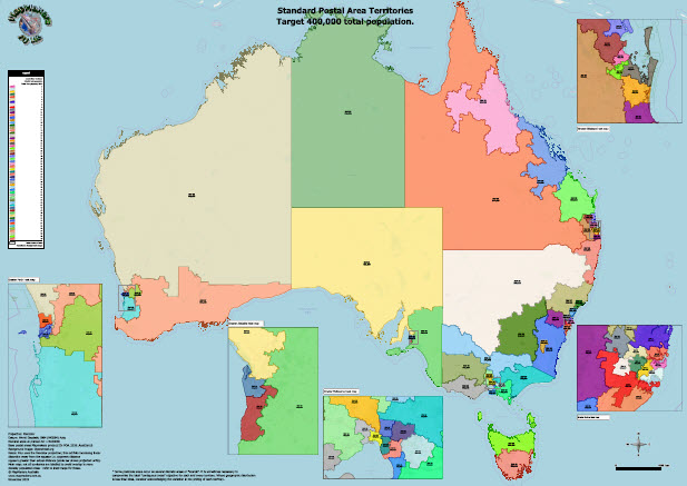
We’re pleased to release two new standard Australian territory / PMA large format (A0) digital PDF maps. Based on the most recent postal area 2016 Census population data. These products group postal areas within each state and territory into sales or marketing areas, each having – as close as practical – a similar total population number. This general approach is well established and is aimed at allowing businesses and franchisors a quick means of fairly dividing and allocating their marketing and other commercial efforts fairly among staff or franchisees. While we are often asked to create such maps for businesses based on more more specific balance targets (see this brief discussion for more details), these two breakdowns of the overall total population into areas of 300,000 and of 400,000 people have proved popular over the years. These off-the-shelf maps represent an affordable entry point for any business wishing to bring this type of insight into their business’ marketing and planning operations.
Each A0 size map is accompanied by a csv file listing all the postal area codes comprising each territory area. Each territory has clear labels for each territory ID together with the total population for that territory. Inset maps make sure the information is readily accessible for capital cities where postal areas – just like population – are most concentrated. There are 2,653 postal areas nationally.
These maps are layer-enabled, allowing the user to switch layers and windows on and off to reveal the detail for all contributing map layers, even using completely free Adobe Reader!
For the TPop300_16_A0 product these are distributed to 79 individual territories, averaging 295,574.
For the TPop400_16_A0 there are 60 individual territories averaging 424,556.


