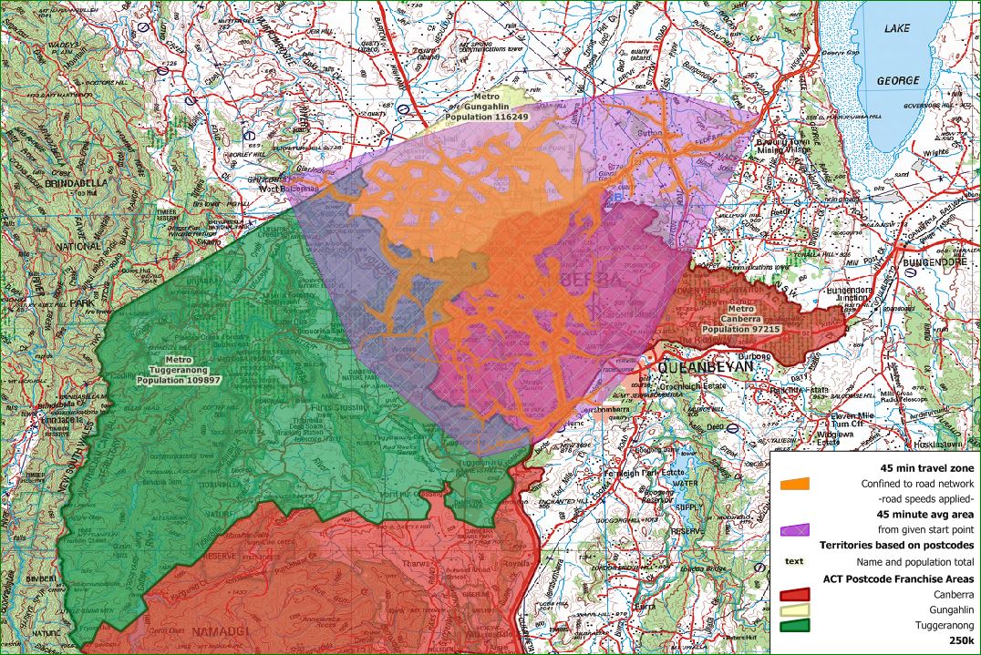
We had an unusual enquiry recently, someone wanted to create operating territories (we do a lot of those) but with an odd requirement – “no more than 45 minutes drive time for each”. We asked whether the operators had operating bases to use as start points – necessary for a drive time analysis, but no, all operated from a central facility. Anyway, we dusted off some old development work based in the ACT which addressed each type of task separately. Here’s a picture showing the two together, illustrating why it’s sometimes difficult to describe in words what can be readily grasped in a map. See how the drive time zones overlap three separate territories? This is because the two analyses were done for different purposes so do not relate directly to each other.

Just an example, two projects, same place, different objectives.
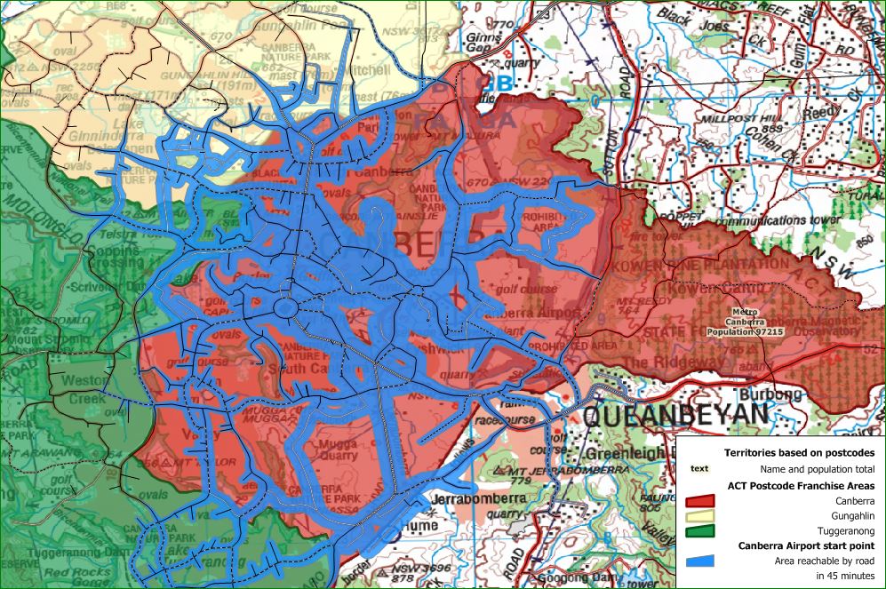
For this enquiry, it might be possible to first define the territories, and then make a separate starting point within each territory to calculate the drive time zones for each and use this as a basis for charge rates for customers’ for example. This has been done in this second map, taking Canberra Airport as the starting location. The blue shows areas reachable by car inside 45 minutes. In practice, that would mean most of the Canberra franchise area. Hopefully this illustration will be helpful to our recent enquirer and to others.

Drive times generated after territory creation with a start point within the territory..
And here’s how it might appear, tidied up, for practical use in a territory document.

Drive time zone tidied up for use within target territory.
When generating a drive time zone, we need to populate the road network with appropriate speeds for the different types of roads, this is sensibly something less than the actual speed limit. The speeds initially used were set for another purpose so here we increased local road speed (local roads / suburban streets) and added several new sections of dual carriageway. It makes a big difference to how far one can travel in a set time! The updated roads result in the green drive time (original zone generated from slower local roads and broken freeway links shown in blue for comparison).

Drive times generated with roads (new freeway sections) and speeds updated
